How the Cappadocia underground cities actually worked
How did Cappadocia's underground cities actually function?
They were built as temporary shelters, not permanent homes, engineered around a single vertical air shaft that fed side rooms on each level, with heavy disc-shaped millstones that rolled across corridors to seal them from the inside during a raid. Stables, cellars, kitchens and wells let a community survive underground for days to weeks, not longer.
Refuges cut into rock, not homes
Cappadocia’s underground cities are usually described by how far they go down, which misses the more useful question: what were they actually built to do. The layouts at Derinkuyu and Kaymaklı point to a single answer. These were shelters for temporary use during raids, not permanent housing. The tuff makes that clear once you know what to look for: storage capacity built for weeks rather than years, ventilation sized for short bursts of crowding rather than constant occupation, and stone doors designed to be sealed from the inside and nothing else.
Above ground, life carried on in ordinary villages, in houses with windows, courtyards and daylight. The underground cities were the fallback, dug into the same soft volcanic tuff that made the fairy chimneys possible, because that rock is soft enough to carve with hand tools and firm enough to hold its shape once cut. When trouble was moving through the region, whole communities could disappear underground for days or weeks, then come back up once it passed.
This guide is about the mechanics of that system: how air moved through 85 metres of rock, how a stone disc could block a corridor, why some cities go deeper than others, and how the levels of a city like Derinkuyu or Kaymaklı actually communicated with each other. It isn’t a walking guide to either site — that’s covered separately for Derinkuyu and Kaymaklı, and compared directly in Derinkuyu or Kaymaklı.
Why a shelter, not a settlement
Cappadocia sat on routes that saw repeated instability over the centuries, and communities living in open villages needed somewhere to go quickly when raiders passed through. Digging down solved several problems at once. A shelter cut into rock is hard to find from the surface, hard to break into once its doors are sealed, and cool and stable in temperature regardless of the season outside.
What the underground cities are not is a solution to permanent housing. There’s no daylight below the first level, ventilation was built to move air for a defined population over a defined period, and the deepest levels served narrow, specific functions — wells, extra storage, sometimes a final refuge chamber — rather than general living space. Archaeologists and site guides describe occupation in terms of days to a few weeks at a stretch, tied to how long a threat lasted overhead, not as a description of daily life. Treat any account that describes hundreds of people living underground year-round as folklore rather than fact.
Digging into tuff: what made this possible at all
None of this works without the rock itself. Cappadocia’s tuff is compacted volcanic ash, thrown out by Mount Erciyes and Hasan Dağı over hundreds of thousands of years, then eroded and weathered into the landscape visible today. Freshly exposed tuff is soft enough to carve with basic iron tools, but it hardens on contact with air over time, so a newly cut room stays workable at first and becomes progressively more stable as its surface cures.
That property let each generation extend a city rather than start from nothing. A stable, hardened upper level provided a secure base from which diggers cut further down, adding new rooms, corridors and levels as the community’s needs grew. This is also why the cities read as additive rather than planned: passages branch off at odd angles, ceiling heights vary between neighbouring rooms, and the layout of Derinkuyu in particular has the feel of successive expansions rather than a single design executed at once.
Moving air through the rock
The hardest engineering problem in an underground refuge isn’t space, it’s air. A sealed volume packed with people, animals and cooking fires runs out of breathable air quickly unless it’s actively ventilated, and that’s the piece of the system most visitors underestimate.
The solution was a network of vertical shafts, cut straight down through every level of a city, usually anchored around one or more main shafts running the full depth. Warm, used air rose and vented at the surface; cooler air was drawn down to replace it, creating a slow, continuous circulation without any mechanical assistance. Side shafts branched off the main one to bring air into individual rooms and corridors rather than leaving air movement confined to the central column.
The same vertical shafts frequently doubled as wells. Because they ran straight down to the water table, a shaft built primarily to move air could also be used to draw water from below, and in some cases to keep water accessible from several levels at once without needing to send someone all the way to the surface. That dual use — one excavated column doing two jobs — turns up repeatedly in how these cities are built, and it’s a better way to understand the design than treating airflow, water and storage as separate systems.
Ventilation quality is also the practical reason some smaller underground cities feel more oppressive to visit than the two main ones. At quieter, less-developed sites such as Özkonak, Mazı and Gaziemir, shaft networks are less complete, lighting is minimal or absent, and the air can feel noticeably more still — worth knowing before you go, and covered in more detail in the quiet underground cities and Mazı and Gaziemir, off the tour route.
Stone doors: sealing a corridor from the inside
The single most photographed feature of any underground city tour is the millstone door, and it earns the attention. Each one is a heavy disc of tuff, cut from a single block and set into a groove built into the rock beside a corridor. In normal times the disc sat open, out of the way. When a threat arrived, it was rolled across the passage to block it completely, wedged in place, and left sealed until the danger passed.
The design works specifically in one direction. A door this size is heavy enough that rolling it into place from inside the sealed section takes real effort but is achievable; rolling it back out from the unsealed side is far harder, close to impossible without help from within. That asymmetry is the whole point — the people sealed inside controlled whether the door opened again. Most doors also have a small hole through the centre, just large enough to see or thrust a spear through, letting defenders monitor or fight through the barrier without opening it.
Cities weren’t sealed as a single unit behind one door. Multiple stone doors at different points let a community close off one section at a time — sealing the entrance while leaving deeper levels open, for instance, or isolating one wing without shutting the whole complex. That sectional sealing is also why the underground cities read less like a single building and more like a series of linked, independently defensible compartments.
a guided walk through Derinkuyu’s stone doors and lower levels is the most direct way to see how this worked in practice, since a guide can point out doors and shaft junctions that are easy to walk past unremarked.
Rooms with a job: stables, cellars, kitchens
Beyond air and defence, an underground city had to feed and house a working community, and the room layout reflects that directly. Stables sat close to the entrance levels, on the logic that livestock needed to be moved down and up relatively quickly and shouldn’t be driven deep into the complex. Low ceilings and worn troughs cut into the rock mark these rooms out clearly from living or storage spaces.
Deeper in, cellars and storage rooms held grain, dried food and other supplies, chosen and positioned to stay at a steady cool temperature — the same property that makes cave hotels comfortable today kept stored food from spoiling underground. Kitchens show blackened ceilings from smoke, and some are positioned near the ventilation shafts specifically so cooking smoke would be drawn upward and out rather than settling in living spaces. A small number of rooms, larger and more finished than the rest, are usually identified as communal spaces or, in Christian-era phases of use, chapels — flatter floors, more careful stonework, sometimes simple carved niches.
None of these rooms is large by modern standards. The construction logic was to fit a defined population for a defined stretch of time, not to build comfortably. Ceiling heights step down noticeably at the lower levels of both Derinkuyu and Kaymaklı, which is a function of the rock and the effort of digging deeper rather than a design choice — cutting a tall room at 70 metres down costs far more labour than cutting one nearer the surface.
How the levels connected
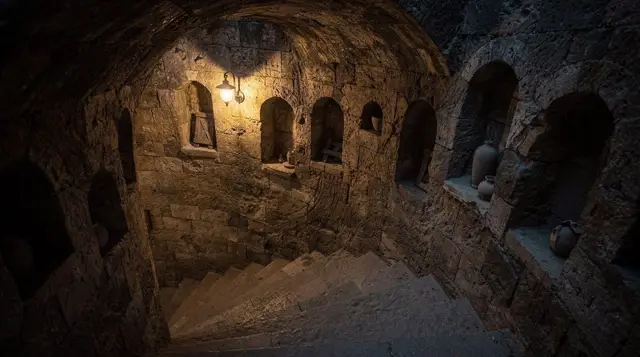
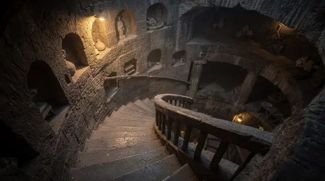
Levels link through narrow stone staircases and low, angled tunnels rather than open shafts you could walk straight down. That’s deliberate as much as practical: a single straight passage from top to bottom would let an intruder move through an entire city unopposed, while a broken, redirected route with doors at intervals meant every section could be defended or sealed on its own.
Tunnels between levels are frequently cut low enough that adults need to stoop, and this is more pronounced at Kaymaklı than at Derinkuyu — one of the clearest practical differences between the two sites, and a factor worth weighing before booking either one, covered directly in Derinkuyu or Kaymaklı. Anyone uneasy in tight, low spaces should read underground cities and claustrophobia before choosing a tour, since the connecting tunnels, not the rooms themselves, are usually what people find hardest.
Why depth and size vary from site to site
Derinkuyu, Kaymaklı, Özkonak, Mazı and Gaziemir are not different sizes of the same design — each grew according to the tuff it was cut from and the community that expanded it, over what’s generally understood to be centuries of intermittent digging rather than one building campaign. Rock quality varies from pocket to pocket across the region, and a site with firmer, more stable tuff could be dug deeper and taller than one where the rock demanded shorter levels and wider support.
Derinkuyu’s 8 open levels and roughly 85-metre depth make it the deepest city regularly open to visitors, a scale usually explained by particularly favourable rock at that location combined with sustained expansion over a long period. Kaymaklı’s 4 open levels are shallower but broader, with more room given to storage relative to living space, and its lower ceilings suggest the diggers prioritised width over headroom as they cut. Neither pattern is better engineering than the other — they’re different responses to different rock and different needs.
The smaller, undeveloped cities follow the same logic on a reduced scale. What limited their size wasn’t ambition but resources: fewer people to dig, quarry access, and time. Visiting one, as covered in Mazı and Gaziemir, off the tour route, gives a rawer sense of the same mechanics — shafts, doors, stables — without the crowds or the added lighting and walkways found at the two main sites.
Derinkuyu and Kaymaklı, side by side
| Derinkuyu | Kaymaklı | |
|---|---|---|
| Levels open to visitors | 8 | 4 |
| Approximate depth | ~85 metres | Shallower, broader footprint |
| Passage character | Taller, more vertical | Lower, more stooped walking |
| Typical visit length | 45–75 minutes | 45–60 minutes |
| Crowd pattern | Busiest late morning to early afternoon | Busiest late morning to early afternoon |
Both sites are usually visited as part of the Green Tour circuit alongside the Ihlara Valley — how that circuit is built is explained in Red Tour, Green Tour, Blue Tour explained. Travellers arranging their own route rather than joining a set-departure tour should also see seeing Cappadocia without a tour.
Seeing it for yourself
Reading about ventilation shafts and rolling stone doors only goes so far; both are far clearer with a guide standing next to one, pointing out what to look for.
A combined tour covering both Kaymaklı and Derinkuyu is the most direct way to compare the two engineering approaches in a single day, since guides on this route typically explain the differences in shaft design and level height as you move between sites. Travellers who want to move at their own pace, ask detailed questions, or avoid group timing entirely can book a private half-day underground city tour with a dedicated guide instead.
For those combining the underground cities with the Ihlara canyon in one outing, a day combining Derinkuyu with the Ihlara Valley pairs the engineering of the underground city with several kilometres of the rock-cut churches lining the canyon above ground — a useful contrast between the two very different uses of the same tuff.
Families weighing whether the tunnels and stairs suit younger children should check underground cities with kids before booking, and anyone building a broader schedule around this visit can start from what a Cappadocia trip costs, Cappadocia itinerary mistakes, or a ready-made two-day plan at Cappadocia in 2 days.
Questions about how the underground cities worked
How deep are Cappadocia’s underground cities?
Derinkuyu descends around 85 metres with 8 levels open to the public, out of many more below that are closed off. Kaymaklı is shallower, with 4 levels open, but its passages are lower and narrower, so people move through it bent over for longer stretches.
How did fresh air reach the lowest levels?
Through a network of vertical ventilation shafts, usually one main shaft per city sunk straight down through every level, with smaller side shafts branching off to individual rooms. The shafts also doubled as wells, so the same vertical channel that moved air often supplied water higher up.
What were the stone doors actually for?
They are large disc-shaped millstones, cut from single blocks of tuff and set into a recess beside a corridor. In an emergency they were rolled across the passage to block it completely; a hole in the centre let defenders see or spear through from the inside while the door held from the outside.
Did people live in these cities permanently?
No. The layout points to temporary refuge during raids rather than settled living: storage for weeks rather than years, no natural light at the lower levels, and ventilation adequate for short-term crowding but not indefinite occupation. Villages above ground stayed the normal, permanent settlements.
How did the different levels connect to each other?
By steep, narrow staircases and low tunnels cut directly into the tuff, often arranged so that no single passage ran straight from top to bottom. Levels were linked in a way that let one stone door isolate a whole section, rather than one continuous open shaft.
Why is Derinkuyu so much deeper than Kaymaklı?
The two sites sit in different pockets of tuff with different rock quality and different water tables, and each was expanded gradually over centuries rather than to a fixed plan. Derinkuyu’s rock allowed deeper, taller excavation; Kaymaklı’s is judged to have been better suited to wider, shorter levels.
Underground city tours on GetYourGuide
Verified deep-linked GetYourGuide tours. Book through these links and we earn a small commission at no cost to you.
GetYourGuide does not provide a product photo for this activity — the image shows the meeting point, photographed by us.