The volcano behind the fairy chimneys
Stand in Rose Valley at sunset, or look south from a cave hotel terrace in Göreme, and there is a wide, pale, snow-streaked cone on the horizon most of the year. That is Erciyes, and it is not a scenic extra. It is the reason the ground under your feet in Cappadocia is soft enough to carve, tall enough to erode into columns, and pale enough to photograph well at dawn.
Erciyes rises to 3,864 m, the highest point in central Anatolia, roughly 25 km south of Kayseri and around 1 h 15 by road from Göreme. It is a stratovolcano, extinct rather than dormant in any way that concerns a visitor, and it sits alongside a second, smaller volcano, Hasan Dağı, 3,253 m, further west near Aksaray. Between them, over roughly nine million years, these two mountains did the geological work that every fairy chimney tour in the region is quietly standing on top of.
This page treats Erciyes as a landscape feature to understand, not a single sight to tick off. If you want the ski resort on its lower slopes, that has its own page — see the Erciyes ski resort guide. If you’re approaching from Kayseri city, that’s covered separately too, in the Kayseri day trip guide. Here, the mountain itself is the subject: what it explains, who should make the trip out to it, and what you’ll actually see if you do.
How a volcano becomes a fairy chimney
The mechanism is worth spelling out, because most Cappadocia visitors get the punchline — “volcanic rock, eroded into cones” — without the steps that make it make sense on the ground.
Erciyes and Hasan Dağı erupted repeatedly over millions of years, throwing out ash, pumice and volcanic debris across what is now the Cappadocia plateau, itself sitting at roughly 1,000 m altitude. That material didn’t cool as solid basalt. It settled in thick layers and compacted into tuf, a soft, porous volcanic rock — pale grey, cream or pink depending on mineral content — that is dense enough to hold a carved room but soft enough to dig with hand tools, which is exactly what people here have done for over a thousand years, from cave churches to entire underground cities.
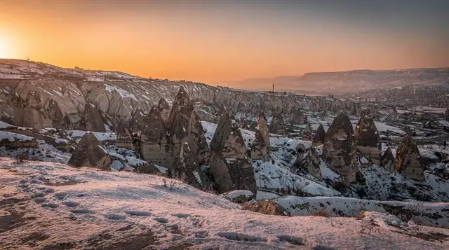
Tuf alone doesn’t make a fairy chimney; it makes a plateau. The columns — peribacalari, “fairy chimneys” in Turkish — appear where a harder cap survived on top of the soft tuf: a layer of basalt or a resistant boulder, laid down by a later, more localised eruption. Rain and wind strip away the exposed tuf around the base far faster than they can touch the rock protected under the cap, so the surrounding land drops while a column, capped like a mushroom, stays standing.
Walk through Paşabağ and look at the double- and triple-capped chimneys, or the odd flat-topped columns of Devrent Valley, and you’re looking at that process at different stages: some caps still intact and sheltering their column, others long since fallen, leaving a bare cone that will erode away within a few more generations.
None of this happens without Erciyes and Hasan Dağı as the source. The valleys tourists walk through, the underground cities at Derinkuyu and Kaymaklı, the whole reason the region looks unlike anywhere else in Turkey, trace back to material these two mountains put into the ground. Erciyes, being larger, closer to the main valley network and still snow-capped for much of the year, is the one you actually see from almost every viewpoint in the region — it’s the visual anchor as much as the geological one.
| Feature | Mount Erciyes | Hasan Dağı |
|---|---|---|
| Elevation | 3,864 m | 3,253 m |
| Distance from Göreme | ~1 h 15 by road | ~1 h 30, via Aksaray |
| Status | Extinct stratovolcano | Extinct stratovolcano |
| Visible from | Most of the Cappadocia plateau on a clear day | Mainly the western valleys, near Ihlara and Aksaray |
| What’s on its slopes | A working ski resort (lower flanks) | Largely undeveloped |
What you actually see, and who it’s for
There’s no single “Mount Erciyes sight” the way there is a Göreme Open-Air Museum or a Uçhisar Castle. What you get depends on how far up you go and what time of year.
From a distance — from any of the standard valley viewpoints, from a balloon at dawn, from the Göreme panorama road — Erciyes is a backdrop: a wide, symmetrical cone, white with snow from roughly November to May, bare and dusty pale in summer. This costs nothing and needs no plan; it’s simply there on a clear day, and it’s the version most visitors actually experience, whether they register it or not.
Closer in, driving up the lower slopes on the Kayseri side, the ground changes from valley farmland to open, stony highland pasture, then scrub, then bare volcanic slope. There are no fairy chimneys up here — that scenery belongs to the plateau below, not the mountain itself — but there’s a clear sense of scale that the valleys don’t give you: from partway up Erciyes, you can look back and see how flat and uniform the plateau is, and how the valleys are cut down into it rather than built up from it.
Higher still, on marked trails in summer, the terrain becomes genuinely alpine: scree, wildflower meadow in June, thin air above around 2,800 m. This is a full-day hiking trip, needs proper footwear and layers even in July, and is not something to combine with a valley walk on the same day.
Given that spread, Erciyes suits a fairly specific reader: someone who wants the geology and the landscape logic of Cappadocia explained rather than another cave church or viewpoint café, and who has either a rental car or is willing to book a driver for a half-day. It is a poor fit for a first Cappadocia trip on a tight schedule — see how many days in Cappadocia before deciding whether this earns a slot — and a poor fit for anyone hoping for a single dramatic photo stop, since its value is contextual rather than a standalone view.
Seeing it without going up
Most visitors get their best look at Erciyes without ever driving toward it. A hot-air balloon at sunrise puts you above the valley floor with Erciyes lit orange in the distance before the plateau below catches the light — worth knowing if that’s the main reason you’re curious about the mountain in the first place:
a standard sunrise balloon flight over the valleys, or, for a slightly more private basket, a smaller-group deluxe balloon flight. Either way, expect the same wind-dependent booking rules as any Cappadocia balloon trip — see the balloon flight guide before you commit a morning to it.
On the ground, the clearest low-effort views come from the eastern valleys and from Ürgüp, where the sightline to Erciyes is largely unobstructed. For anyone chasing a specific composition rather than just a glimpse, the Cappadocia viewpoints guide has more on where the mountain sits well in frame against the valleys.
Getting onto the mountain itself
Independent hikers with a car can drive most of the way up the lower slopes on the Kayseri side and start walking from marked trailheads in summer; the hiking safety guide covers general terrain advice that applies here too, though Erciyes is higher, more exposed and colder at altitude than any valley walk in the region. Weather changes fast above 2,500 m, and there’s little shade or shelter, so this isn’t a trip to start in the afternoon.
For a guided option that covers a fuller day on the mountain and surrounding highlands without arranging your own transport, a full-day guided hike through the wider Cappadocia national park area is the closest match among bookable tours, though check the exact route before booking, since Erciyes ascents specifically are less commonly packaged than valley walks. If you’d rather build a dedicated trip around it, the 4-day hiking itinerary and the best hikes in Cappadocia guide both give Erciyes proper standing alongside the valley trails rather than treating it as an afterthought.
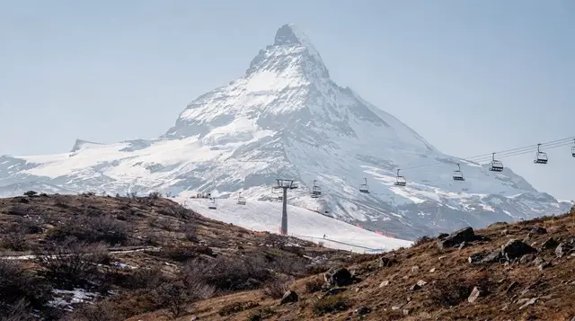
Skiing is the other reason people go up Erciyes, on lower-altitude pistes served by lifts on its northern flank, roughly December to April depending on snowfall. That resort has its own detailed page — see the skiing on Mount Erciyes guide for lift passes, gear hire and access — and isn’t covered further here.
Beyond the mountain: what’s nearby
Erciyes sits at the centre of a cluster of sites that most itineraries skip because they’re a genuine detour from the main valley circuit, not a short add-on.
Roughly 40 minutes north-east of the mountain, near Kayseri, is Kültepe, the ancient Assyrian trading colony of Kanesh, which produced more than 20,000 cuneiform tablets — the oldest written records found in Anatolia. It’s a quiet, low-key archaeological site rather than a visually dramatic one, and pairs naturally with an Erciyes day if you’re already out that way; see the Kültepe guide for what’s actually on show.
South-east of the mountain, Sultansazlığı is a wetland and bird reserve, a genuinely different landscape from anything else in the region — flat marsh and open water rather than volcanic rock. The Zamantı river, which rises on Erciyes’s flanks, offers rafting further downstream toward Kapuzbaşı waterfalls; the rafting the Zamantı guide has the practical detail.
Further south again, the Aladağlar mountain range is a serious multi-day trekking destination in its own right, well beyond a Cappadocia day trip, covered in the trekking the Aladağlar guide.
None of these are essential. They’re here because Erciyes is genuinely a different kind of day from a valley walk or an underground city, and travellers who make the trip out this way often want to know what else justifies the drive.
Planning notes
A rental car is the simplest way to reach the mountain’s lower slopes; driving in Cappadocia and car rental in Cappadocia cover what to expect on regional roads, which are generally in good condition but climb steeply once you leave the plateau. Without a car, a private driver booked through your hotel in Göreme is the realistic alternative — public dolmuş minibuses serve Kayseri, not the mountain itself.
Bring layers regardless of season: even in July, wind at altitude on Erciyes is markedly colder than the valley floor, and cloud can close in with little warning. Sun protection matters more than on a shaded valley walk, since there’s little cover above the treeline. If skiing is the goal rather than hiking or sightseeing, check current conditions before travelling — snow cover on the lower pistes varies considerably by year and by month within the December–April season.
Common questions about Mount Erciyes
Can you see Mount Erciyes from Göreme?
Yes, on a clear day. Erciyes is visible from many points around Göreme and the surrounding valleys, roughly 1 h 15 away by road, and it’s a common backdrop in balloon-flight photos taken at sunrise over the region.
Do I need to visit Mount Erciyes to understand the fairy chimneys?
No, but it helps. The fairy chimneys form from tuf — compacted volcanic ash and debris — that Erciyes and Hasan Dağı deposited across the plateau over millions of years. You can appreciate the chimneys without ever seeing the source mountain up close, but visiting it makes the connection concrete rather than abstract.
Is Mount Erciyes the same as the Erciyes ski resort?
Not quite. Erciyes is the mountain itself; the ski resort occupies lifts and pistes on its lower northern slopes and is a separate, bookable destination with its own facilities, covered on its own page rather than folded into general mountain sightseeing.
How long does a trip to Mount Erciyes take from Göreme?
Budget half a day for a viewpoint drive and short walk, or a full day if you’re hiking higher trails in summer. Add travel time on top: roughly 1 h 15 each way by road from Göreme.
Is Hasan Dağı worth visiting alongside Erciyes?
Only if you’re already near Aksaray or the Ihlara valley, since it’s roughly 1 h 30 from Göreme in a different direction to Erciyes. It’s the less-developed of the two volcanoes, with no resort infrastructure, and mainly of interest to the same geology-minded traveller who’d want to see Erciyes.
Do I need a guide to visit Mount Erciyes?
Not for the lower-slope viewpoints, which are reachable by rental car. A guide or organised hike is more useful for the higher summer trails, where route-finding and weather judgement matter more than on a marked valley walk.
Is Mount Erciyes worth it if I only have a few days in Cappadocia?
Generally not the highest priority. With two or three days, the valleys, the Göreme Open-Air Museum and one underground city will fill your time more efficiently. Erciyes suits travellers with four or more days, or a specific interest in geology and mountain landscapes over valley sightseeing.