Hiking safety in Cappadocia's valleys
What's the biggest safety risk when hiking in Cappadocia's valleys?
The volcanic tuff underfoot turns slick after rain, including sections that felt solid the day before. Combine that with almost no shade, no water points along most trails, and mobile signal that drops out in the deeper canyons, and the real risk is being unprepared rather than the terrain itself.
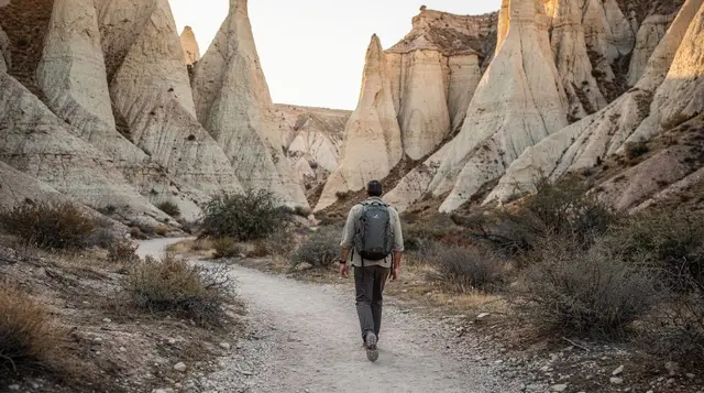
Cappadocia’s valleys look gentle from a viewpoint café: soft rock, a marked entrance, a few other walkers heading the same way. On the ground they behave differently. This guide covers the safety rules that apply across every valley around Göreme, rather than the route-by-route detail that’s covered on each valley’s own page. If you want turn-by-turn walking notes, start with the best hikes in Cappadocia and come back here before you actually set off.
Why the valleys catch people out
None of this is extreme hiking. Most valley trails lose only 50 to 150 metres of elevation between the plateau and the valley floor, and a walk rarely takes more than two to three hours. What causes trouble isn’t difficulty, it’s that the terrain looks more stable than it is, the sun is stronger than it feels, and help is further away than the short distances on a map suggest. Four things account for most of the problems: the rock surface, the lack of shade, the absence of water along the way, and patchy phone signal once you’re below the rim.
The tuff turns slick after rain
The valleys are cut into volcanic tuff, a soft, porous rock that erodes easily and holds water on its surface rather than letting it soak straight in. In dry weather it’s simply dusty and a little loose underfoot. After rain, or overnight dew that hasn’t burned off yet, that same surface turns into a thin, slick paste, and it stays that way for longer than the ground looks like it should. A stretch of path that felt firm the previous afternoon can be genuinely dangerous the next morning, particularly on the steeper descents into Red Valley and Love Valley, where the trail drops quickly over bare rock.
The practical rule is simple: if it has rained in the last day, or the ground is visibly damp, treat every descent as slower and more careful than usual, and skip the steepest sections altogether if you’re not confident on your feet. Trekking poles help more here than on most hikes, because they give you a second and third point of contact on a surface that offers very little grip. Closed shoes with a real tread are worth far more than how they look; this is not a valley system that forgives sandals.
There’s almost no shade
With one exception, Cappadocia’s valleys are open country: eroded rock, low scrub, and very little tree cover. Zemi Valley is the one valley with meaningful shade along its stream bed, and it’s worth knowing that if you’re hiking in the middle of the day in summer. Elsewhere — Rose Valley, Red Valley, Love Valley, Pigeon Valley, Sword Valley, White Valley — you’re exposed to direct sun for nearly the whole walk, with only the occasional rock overhang to duck under.
In July and August, afternoon temperatures regularly reach 30 to 35 degrees, and there’s nothing between you and the sun for hours at a time. The straightforward fix is to walk early: start by 8am or 9am and you’ll be back before the worst of the heat, rather than starting at midday because it fits the rest of the itinerary. A hat and sunscreen are not optional extras here, and reapplying sunscreen matters more than people expect on a walk that runs two or three hours.
Water: carry it, because you won’t find any
There are no fountains, kiosks or shops along the trail inside any of these valleys. Whatever water you’re carrying when you start is what you have until you reach the far end or turn back. In summer heat, two litres per person is a reasonable minimum for a half-day walk, more if you’re combining valleys or walking the longer Ihlara Valley route, where the walk between the main staircase and Belisırma runs close to four kilometres one way with no services in between.
Running short of water in an open, shadeless valley in summer heat is one of the more common ways a pleasant walk turns into a genuinely uncomfortable one, and it isn’t rare. Carry more than you think you’ll drink, and treat an empty bottle halfway through as a signal to turn back rather than push on.
Trail forks, dead ends, and drops with no warning
These paths were mostly cut by farmers reaching orchards and pigeon houses, not laid out for walkers, and that shows at the junctions. Side paths peel off toward a cave entrance, a farmed plot, or simply stop at an eroded drop, without a signpost to say which branch is the through-route and which one goes nowhere. It’s easy to end up fifteen minutes down a path that dead-ends at a rock face or a genuine drop-off, then have to retrace your steps.
GPS apps are not much help here. Consumer GPS accuracy in a narrow, walled valley is often off by enough to put you on the wrong side of a ridge on the map, and offline map tiles rarely show the informal paths that actually exist on the ground. The safer habit is to treat every unmarked fork the same way: if you’re not sure which branch continues, take the option that looks more worn, and if that runs out or narrows into scrambling terrain, go back rather than improvise a way down.
This matters most in the quieter valleys — Devrent, Sword Valley, Meskendir Valley — where there are fewer other walkers around to double-check a route with, or to notice if you don’t reappear.
When the signal drops
Mobile coverage in Cappadocia is generally solid on the plateau, in Göreme, Ürgüp and Uçhisar, and thin to non-existent once you’re down inside a narrower valley with rock walls on both sides. It comes and goes rather than failing completely, which is in some ways worse: a map loads at the trailhead, then loses your position exactly at the fork where you needed it most.
The practical response is to download an offline map of the valley before you leave your hotel’s wifi, note the walk’s start and end points on paper or from memory, and treat any live map as a bonus rather than something to depend on. If you’re walking with someone, tell a third person roughly which valley you’re in and when you expect to be out, the same habit you’d use for any hike where phones aren’t reliable.
What to carry
| Item | Why it matters here |
|---|---|
| Two litres of water per person | No fountains or shops on any valley trail |
| Closed shoes with real tread | Tuff is loose when dry, slick when wet |
| Hat and sunscreen | Almost no shade outside Zemi Valley |
| Offline map, downloaded in advance | Signal drops inside narrower valleys |
| Trekking poles (optional but useful) | Extra grip on steep, loose descents |
| A note of your plan left with someone | Phones aren’t reliable for check-ins mid-valley |
Guided or solo: when it’s worth having someone with you
None of this means the valleys require a guide by default. Rose Valley and Pigeon Valley are walked solo every day by visitors with no hiking experience, and the paths are clear enough on a dry morning with a downloaded map. Where a guide earns its cost is exactly where the risks above compound: after rain, in the less-walked valleys, or if you want to combine several valleys and the Göreme Open-Air Museum in one outing without working out the connecting paths yourself. A local guide also knows which forks lead somewhere and which don’t, which removes most of the dead-end problem outright.
a guided hike through the valleys combined with the Göreme Open-Air Museum covers several valleys in one outing with someone who knows the junctions. If you’d rather walk in the cooler, calmer light at the end of the day, a sunset hiking tour with a local guide avoids the worst of the afternoon heat while still finishing before dark. For a quieter route away from the busiest valleys, a guided walk through the Pancarlık and Gomeda valleys covers ground that gets far fewer visitors on foot, with a guide who knows the paths.
If walking isn’t the priority and you’d rather cover the valleys a different way, horseback and quad options exist for covering the valleys without the same trail risks, and are worth considering if mobility, heat tolerance, or time is a bigger constraint than distance.
If you get into trouble
Turkey’s single emergency number is 112, and it connects to ambulance, police and fire from any phone, though signal underground in a valley may not reach it. If someone is hurt and you have no signal, the fastest realistic option is usually to walk back toward the entrance you came in from, since that’s the direction where signal and other people are most likely to reappear, rather than continuing further into the valley hoping for a quicker way out. Describe your location by the nearest named landmark — a specific rock formation, a church, the valley entrance — rather than relying on coordinates, since not every emergency line handles a dropped pin cleanly.
Heat exhaustion is at least as common a problem as a fall, and it builds quietly: dizziness, nausea, a headache, and stopping sweating despite the heat are the signs to stop for. Sitting in whatever shade exists, drinking water slowly rather than all at once, and waiting before continuing is usually enough if caught early. None of these valleys are remote in the way a mountain hike can be remote — Göreme, Ürgüp and Uçhisar are never more than a few kilometres away — but that closeness on a map doesn’t help much if you’re the one who has to walk out.
Before you go, it’s worth reading what to pack for Cappadocia and the wider safety and scams guide, and if reduced mobility is a factor, this guide to visiting Cappadocia with limited mobility covers which sites and valleys are realistic and which aren’t.
Solo travellers should also see solo travel in Cappadocia for notes specific to walking these valleys alone. None of the risks here should put you off the valleys — they’re one of the best reasons to come to Göreme — but a short checklist before you set off turns a genuinely good walk into one without an unpleasant surprise halfway through.
Hiking safety in Cappadocia’s valleys: common questions
Is it safe to hike Cappadocia’s valleys without a guide?
On a dry day, on the better-marked routes such as Rose Valley or Pigeon Valley, most reasonably fit adults manage fine without a guide. The risk climbs after rain, in valleys with fewer other walkers, and at unmarked forks where a wrong turn can lead to a dead end or a drop rather than back to the path.
What should I do if a trail forks and there’s no signpost?
Turn back the way you came rather than pushing on to see where a fork leads. Cappadocia’s valley trails were cut by farmers and shepherds, not laid out for walkers, so a promising-looking path can simply stop at a rock face or an eroded drop with no warning.
Which valley has shade if the heat gets too much?
Zemi Valley is the one exception, with more tree cover along its stream bed than the other valleys around Göreme. Rose Valley, Red Valley, Love Valley, Pigeon Valley and Sword Valley are almost entirely open, with only occasional shade from a rock overhang.
Do I need hiking boots, or will trainers do?
Closed shoes with real grip matter more than the brand. The tuff surface is loose and dusty in dry weather and turns to a slick paste after rain, and open sandals or worn-out soles are a common cause of slips on the descents.
Does my phone work for maps once I’m inside a valley?
Not reliably. Mobile signal drops in and out along the deeper, narrower stretches of most valleys, so a map app can lose your position exactly when you need it. Download an offline map before you set off and treat it as a backup, not a live guide.
What happens if someone is hurt or lost on a trail?
Call 112, Turkey’s single emergency number, if you have any signal at all, and try to describe your location by the nearest named landmark rather than GPS coordinates that may not resolve. If there’s no signal, the fastest option is usually to walk back out toward the entrance rather than waiting.
Is the tuff dangerous on a dry day too?
Less so, but not risk-free. Loose grit sits on top of the harder rock on most descents, so ankles turn and feet slide even in dry conditions, particularly on the steeper drops into Red Valley and Love Valley.
Hiking & nature tours on GetYourGuide
Verified deep-linked GetYourGuide tours. Book through these links and we earn a small commission at no cost to you.
GetYourGuide does not provide a product photo for this activity — the image shows the meeting point, photographed by us.