Trekking the Aladağlar
Can I hike the Aladağlar as a day trip from Göreme?
Only the fringes, and only with a car and a driving day of around two and a half hours each way. The interior routes around Yedigöller and Emli Valley need an overnight base near Çukurbağ or Demirkazık, proper mountain fitness, and a realistic season of roughly June to September.
A different mountain range entirely
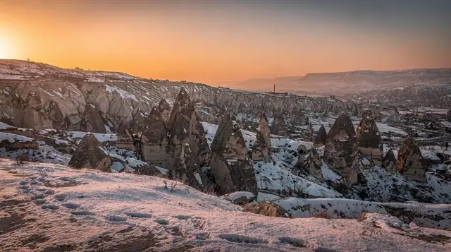
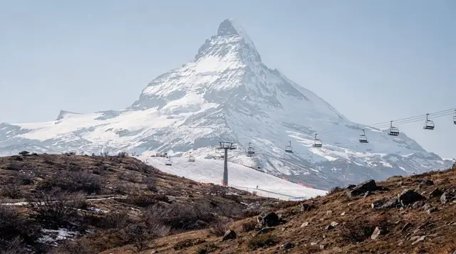
Everything else on this site about walking in Cappadocia is about tuf: soft volcanic rock, flat-bottomed valleys, a couple of hours of easy strolling between Rose Valley and a viewpoint café. The Aladağlar is not that. It’s a limestone massif in the wider Taurus mountain system, sitting well south of the Cappadocian plateau, with summits over 3,000 metres, permanent snow patches into summer on the shaded faces, scree slopes, and weather that behaves like mountain weather rather than plateau weather.
If you’ve walked Love Valley or the Ihlara Valley and are wondering whether the Aladağlar is a bigger version of the same thing, it isn’t. It’s a separate destination that happens to be reachable, with effort, from a Göreme base.
The range takes its name — Aladağlar means “the mottled” or “the piebald mountains,” a reference to the patchwork of exposed grey rock and pale snow — and it straddles the provinces of Niğde, Kayseri and Adana. The highest point, Demirkazık, tops 3,750 metres. None of this belongs on the same page as the fairy chimneys, and it shouldn’t be sold as one. A rough comparison of what each landscape actually offers:
| Göreme valleys (Rose, Red, Love, Pigeon) | Aladağlar | |
|---|---|---|
| Rock type | Soft volcanic tuf | Hard limestone |
| Terrain | Flat valley floors, gentle slopes | Steep approaches, scree, ridgelines |
| Altitude | Around 1,000 m | 1,400 m trailheads to 3,750 m summits |
| Typical walk | 1–3 hours, no navigation needed | Full day to multi-day, map/GPS needed |
| Season | Practical most of the year | Realistically June to September |
| From Göreme | 5–20 minutes | 2.5 hours+ by road |
| What’s there | Cave churches, fairy chimneys, wine | Alpine meadows, canyons, snowfields |
Where the Aladağlar actually is
The range sits south of Niğde, itself around one hour fifteen from Göreme by road. From Niğde, the trailhead villages — Çukurbağ and Demirkazık chief among them — are another 45 minutes to an hour further, much of it on narrower roads that climb steadily. In practical terms, that puts a serious trailhead at two and a half to three hours from a Göreme hotel, one way. This is not a distance you cover on a dolmuş; you need a hire car, a driver, or an organised trip that includes the transfer.
The approach itself is worth doing slowly. The road south from Nevşehir and Niğde passes through a landscape that changes noticeably — the plateau gives way to foothills, then to the grey wall of the range itself, visible for a good stretch before you reach it. Gümüşler Monastery, a Byzantine rock monastery just outside Niğde, sits directly on this route and is the natural stopping point for anyone who wants a cultural anchor to the day without committing to a full mountain trek — more on that pairing below.
What’s actually up there
The core of the range, for a hiker rather than a technical climber, is the approach into Yedigöller (“seven lakes”) and the Emli Valley, both reached from the Çukurbağ or Demirkazık side. These are proper mountain valleys: pine and juniper lower down, giving way to alpine meadow, then bare rock and scree as you gain height. Streams run clear and cold off the snowfields even in July. Ibex are present in the higher, quieter sections, though sightings are not guaranteed.
The peaks themselves — Demirkazık at 3,756 metres, Kızılkaya, the Emli group — are a different proposition again. Several of the standard routes to these summits involve scrambling over loose rock and, on some lines, short sections of exposed climbing that call for a rope and the experience to use one. This is genuinely mountaineering terrain in places, not a strenuous walk, and it should never be undersold as such to someone without hill or alpine experience. If you’re an experienced hiker without technical climbing background, the valley approaches, the walk to Yedigöller, and lower ridge viewpoints are achievable and rewarding on their own, without going anywhere near the technical ground higher up.
Distances and times from a Çukurbağ or Demirkazık base, for orientation rather than as a route guide:
| Destination | Approx. time from trailhead | Terrain |
|---|---|---|
| Emli Valley entrance | 1–2 hours | Gentle, well-trodden path |
| Yedigöller (seven lakes) | 5–7 hours return | Steep in sections, full day |
| Alpine meadow camps | 3–4 hours in | Steady climb, camping possible |
| Demirkazık summit | 2 days typical | Scrambling/technical, guide recommended |
Season: shorter than the plateau’s
Cappadocia’s plateau has a workable hiking season from roughly April to October, with winter closing most of the valley walking to snow and ice rather than danger. The Aladağlar’s window is tighter. Snow lingers on the higher slopes and passes well into May in a heavy year, sometimes later on the shaded north faces, and afternoon thunderstorms are a regular feature of July and August at altitude — the kind that build fast and are genuinely dangerous on an exposed ridge.
June through September is the realistic bracket for the higher routes; the lower Emli Valley approach can sometimes be done a few weeks either side of that. This is worth checking against current conditions before you commit a day to it, and it’s a very different calendar from anything covered in the best time to visit guide for the plateau proper.
Getting there and getting around
There’s no dolmuş network into the Aladağlar the way there is between Göreme, Ürgüp and Avanos. Your options are a hire car — see the notes on driving in Cappadocia and car rental before you decide — a private driver for the day, or a organised excursion that packages the transfer with a lower-valley walk or the Gümüşler Monastery stop. For anyone heading into the interior for an overnight trek, a local guide is the sensible call: paths are not waymarked to Göreme-valley standards, junctions are easy to miss, and mobile signal drops out well before you reach the interesting terrain.
Çukurbağ and Demirkazık villages both have small pansiyons aimed at climbers and hikers, considerably more basic than a Göreme cave hotel and not run to the same tourist-facing standard — expect simple rooms, home-cooked meals, and hosts who know the mountain rather than a concierge desk. Booking ahead in season is worth it; these are small operations with few rooms.
A realistic day trip: Gümüşler and the fringe
For most visitors based in Göreme, a full Aladağlar trek is not the plan that fits a typical stay. The more achievable version pairs the drive south with Gümüşler Monastery — a well-preserved Byzantine complex carved into rock near Niğde, notable for a fresco of the Virgin and Child considered one of the best-preserved of its kind in the region — and a shorter walk or viewpoint stop on the mountains’ lower flank, without pushing into the interior.
a day tour that combines Gümüşler Monastery with a look at the Aladağlar National Park fringe covers exactly this pairing without requiring you to arrange your own transport for a three-hour round trip. A similar option, a Gümüşler day trip built around history and local food, leans more into the cultural stop and a shared meal than mountain walking, which suits visitors who want the monastery and the scenery without a strenuous hike attached.
If the appeal is really about covering varied ground rather than trekking specifically, it’s worth being honest that a jeep safari through Cappadocia’s back country and an ATV tour across the plateau are built around the volcanic valleys near Göreme, not the Aladağlar — they’re a different day out, not a substitute for a mountain trip, and worth choosing on their own terms rather than as an “instead of.”
What to pack that a valley walk doesn’t need
A Cappadocia packing list built for Göreme’s tuf valleys — sun hat, sturdy trainers, a couple of litres of water — underprepares you here. For the Aladağlar, add proper hiking boots with ankle support, layered clothing to handle a swing of 15 to 20 degrees between the warm trailhead and a cold, windy ridge, a genuine waterproof shell rather than a light jacket, more water than you’d carry for a three-hour valley walk, and either a paper map of the range or a downloaded GPS track — do not rely on phone signal once you’re past the lower meadows.
A basic first-aid kit and a whistle are standard mountain-hiking sense, not overkill, given how thin the foot traffic is on the interior routes compared with anywhere near Göreme.
None of the guidance in hiking safety in the valleys, written for the tuf canyons around Göreme, covers altitude, exposure or scrambling terrain — treat the Aladağlar as its own safety brief, not an extension of that one.
Pacing yourself around a mountain day
The biggest mistake visitors make is treating the Aladağlar as one more stop on a busy sightseeing list. A mountain day has its own rhythm: an early start, a steady pace on the way up, and a clear decision point about when to turn around. If you are used to the relaxed tempo of the Göreme walking guide routes, where a café is never far away and the path is obvious, expect to slow down and to plan your food and water before you leave the village rather than improvising on the trail.
Weather is the other variable. Mornings are usually the calmest part of the day in the mountains, which is a good reason to be on the trail early and heading down before the afternoon build-up. If the sky darkens over the ridgeline, the right answer is to descend, not to push on for the view. That habit will serve you well on any hike, including the Meskendir Valley hike or the Zemi Valley hike, but it matters far more here, where shelter is scarce and help is far away.
Building the trip around the mountains
If the Aladağlar is your main reason for coming south, treat it as a block of its own rather than a day squeezed between balloon flights and museum visits. Many walkers choose to spend a night or two near the trailheads, then return to the plateau for something gentler. A slow day afterwards, such as the one described in a slow day in Cappadocia, is a good way to let tired legs recover without wasting a day of the trip.
Think about the order of your stay, too. Doing an easier valley first, for example the Rose Valley hike or the Pigeon Valley trail, lets you test your boots, your pace and your fitness before committing to a long drive and a harder day. If something is not right, you have lost very little. Anyone weighing how many days to set aside overall will find the how many days in Cappadocia guide a useful companion, and the guided tour versus self-drive comparison helps with the question of whether to hire a car or hand the logistics to someone else.
Choosing between the mountains and the plateau
Some travellers arrive with only a few days and have to choose. The honest answer is that the plateau offers more variety per hour of travel, while the mountains offer something the plateau cannot: space, silence and a sense of scale. If your priorities are cave churches, pottery and food, the Goreme Open Air Museum guide and the Avanos walking guide will give you a fuller return for your time. If you already know the plateau and want something different, the mountains are a natural next step.
For those who prefer to compare the range with other high ground in the region, the Mount Erciyes guide describes a very different kind of mountain, and the valleys on foot, quad or horseback comparison shows how the plateau handles the same question of how best to cover ground. Whatever you decide, check conditions close to your date, tell your accommodation where you are going, and keep the plan flexible enough to change if the weather or your legs tell you to.
Who this is actually for
Worth saying plainly: this is not the excursion for a first Cappadocia trip. Most visitors get far more from the accessible valley walks around Göreme and Ürgüp, none of which demand a hire car, a mountain fitness base, or a full day’s driving.
The Aladağlar suits an experienced hill walker, ideally on a second or longer visit to the region, who has their own transport or is willing to book a specialist trekking operator, and who is coming with realistic expectations about elevation gain, exposure and a shorter usable season than the plateau enjoys. If any of that doesn’t describe you, the mountains are still worth seeing — from a road viewpoint on the Niğde road, or paired with Gümüşler Monastery as a half-day outing — without pretending a serious trek is a casual add-on to a Göreme-based holiday.
For context on the wider volcanic geology that shaped the region the Aladağlar borders, the volcanoes that made Cappadocia and the Mount Erciyes guide cover the other side of this story — the young volcanic cones rather than the older limestone range.
Anyone planning several days around outdoor activity rather than sightseeing might also look at the four-day hiking itinerary, though note that itinerary is built around the plateau valleys, not the Aladağlar interior, and budgeting for a trip that mixes both should be checked against what a Cappadocia trip costs before booking transport and accommodation separately for the mountain leg.
Cappadocia’s mountains, in short
Ask this section’s questions again, briefly: the Aladağlar is not part of the fairy chimney landscape, it’s two and a half hours or more from Göreme each way, its hiking season runs roughly June to September rather than most of the year, and its interior routes call for hiking fitness, navigation and — on the summits — mountaineering experience that a valley walk never requires. Treat it as a genuinely separate trip within a Cappadocia stay, plan the logistics accordingly, and it delivers a landscape that nothing near Göreme can match. Treat it as a bigger version of Rose Valley, and it will catch someone out.
Mountain excursions on GetYourGuide
Verified deep-linked GetYourGuide tours. Book through these links and we earn a small commission at no cost to you.
GetYourGuide does not provide a product photo for this activity — the image shows the meeting point, photographed by us.