Ortahisar: a walking guide to the village and its castle
Is Ortahisar the same as Uçhisar?
No. They are two separate villages roughly ten minutes apart by road, each built around its own rock outcrop. Ortahisar's stone piton is about 86 metres tall, the village sees far fewer visitors than Uçhisar, and it is not a stop on the standard Red or Green Tour circuits.
The village most visitors drive straight past
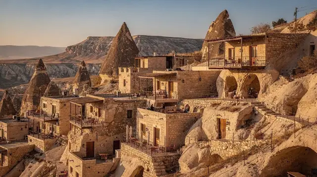
Ortahisar has a problem with its own reputation, or rather with its neighbour’s. Show most people a photo of a stone spire rising out of a Cappadocian village and they will guess Uçhisar, because Uçhisar’s rock is the one on the postcards and the one every Red Tour minibus stops beside. Ortahisar’s rock does the same trick on a smaller scale, about 86 metres of pale tuff riddled with carved rooms and tunnels, standing over a village of roughly the same size. The two are often confused, and the confusion is worth clearing up before you plan a day, because they are not interchangeable stops on the same list — they are two different experiences of the same kind of place.
This guide covers a walk around Ortahisar itself: the climb up through the rock, the streets and storage caves below it, how the village differs in practice from Uçhisar, and how to get here on foot from Göreme if you would rather walk than drive.
The piton and the castle climb
The Ortahisar rock — often called the castle, though it was never a fortress in the conventional sense — is a freestanding pillar of volcanic tuff that has been hollowed out over centuries into a warren of rooms, storage chambers, and connecting passages.
A ticket bought at the entrance gets you onto a marked route that climbs through the carved interior to a series of openings and platforms near the top, with views out over the surrounding valleys and, on a clear day, as far as the cone of Erciyes beyond Kayseri. Allow 45 minutes to an hour for the climb itself; the stairs and passages are uneven stone, narrow in places, and not lit to the standard of the region’s underground cities, so a torch on your phone is useful even in daylight.
Compared with the climb at Uçhisar, Ortahisar’s is shorter and less structured — there is less of a defined circuit, more of a sense of picking your way through openings that were cut for storage and shelter rather than for a modern footpath. That is part of the appeal for some visitors and a minor frustration for others expecting clear signage throughout.
The village below the rock
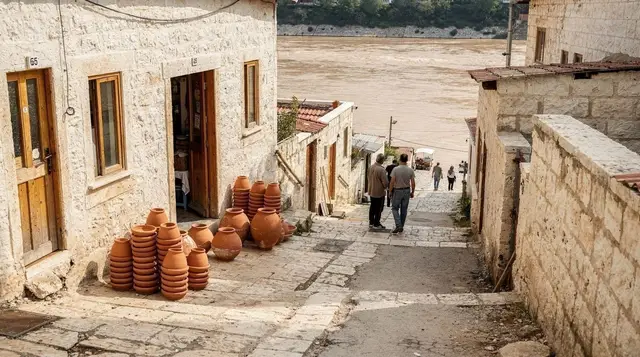
Below the rock, Ortahisar is a working village first and a destination second. The main square, near the mosque, has a small cluster of cafés and shops, but nothing like the density of souvenir stalls found in Göreme or Ürgüp. Streets run off in several directions past stone houses, some still lived in, some converted, with fig and apricot trees in courtyards and washing hung between buildings. It is a pleasant place to walk without a fixed itinerary for half an hour after the castle climb.
Scattered through the village and cut into the base of the rock are old storage caves, used historically to keep citrus fruit — brought up from the coast — cool and slowly ripening through the winter, along with other produce that needed a stable temperature. A few of these are set up for visitors to look into; most are simply part of the village’s working infrastructure, still doing the job they were carved for. There is no single ticketed “museum” experience here comparable to the Göreme open-air site — this is closer to walking through a village that happens to have a several-hundred-year-old cold-storage system built into it.
Ortahisar also has at least one cave venue running an evening show with a set dinner, aimed at visitors staying in the area rather than day-trippers passing through:
a traditional dinner and show in one of Ortahisar’s cave venues is worth building an evening around if you are based nearby rather than in Göreme itself.
Ortahisar or Uçhisar: which to choose
If you can only fit one rock-village stop into a tight schedule, the honest comparison looks like this.
| Ortahisar | Uçhisar | |
|---|---|---|
| Rock height | About 86 m | The highest point in the Cappadocia region |
| Crowds | Noticeably lighter | Heavy, especially mid-morning to late afternoon |
| Village character | Working village, few visitor amenities | Built substantially around tourism |
| On standard tour circuits | No — visited independently | Yes — a stop on the Red Tour |
| Views | Wide panorama, less structured route | Wider panorama, clearer viewing platforms |
| Time needed | 1–1.5 hours | 1–1.5 hours |
Neither is a mistake to visit — the honest answer is that they solve different problems. Uçhisar gives you the taller viewpoint and is easy to combine with a Red Tour day. Ortahisar gives you something closer to what the region’s villages generally looked like before tourism reorganised so many of them, at the cost of a slightly less polished visitor experience. If your schedule allows both, they pair well as a single morning, roughly ten minutes apart by road; see how the two compare against a wider set of bases in the Göreme, Ürgüp, or Uçhisar breakdown if you are still deciding where to stay rather than just where to visit for an hour.
Walking from Göreme via Meskendir valley
Ortahisar sits about ten minutes from Göreme by road, but there is also a walking route that avoids the road entirely: down through Meskendir valley, which connects the two on foot through open, eroded valley terrain rather than along the highway. This is a genuine link between the two places rather than a detour — it is the route locals and hikers actually use — but it deserves to be treated as its own outing, not squeezed in as a footnote before a castle climb.
The path has little shade, the ground is loose tuff and gravel that turns slippery when wet, and phone signal drops out in the lower sections, so carry water and start earlier in the day in summer. Full route notes, timing, and what to expect underfoot are covered separately in the Meskendir valley walk guide — read that before setting out rather than relying on this page for turn-by-turn detail.
Arriving in Ortahisar on foot rather than by car or taxi changes the visit a little: you come in from below, past the storage caves at the base of the rock, rather than parking near the square and starting at the ticket booth. It is a good way to see the village side of Ortahisar before the castle climb rather than after it.
Combining Ortahisar with a wider day
Because Ortahisar is not on the fixed Red or Green Tour route, seeing it usually means either driving yourself, taking a taxi from Göreme, walking in via Meskendir valley, or building it into a private itinerary. A guided day that covers several of the region’s quieter villages and valleys together is one way to do this without arranging transport yourself:
a guided day through Cappadocia’s quieter valleys and villages can be worth it if Ortahisar is one stop among several you want covered without driving. For those who would rather walk than ride between sights, a guide-led evening option covers some of the same ground on foot, timed for lower light:
a guided sunset hike through the valleys around Göreme is a reasonable pairing if you have already walked Meskendir valley in daylight and want a second, different walk later in the trip. If Ortahisar is one stop on a fuller regional day rather than the focus of it, the standard circuit that covers the open-air museum and northern valleys is a separate, more conventional option:
a full-day guided tour combining the region’s main northern and southern sights though note again that this circuit does not stop in Ortahisar itself — it is a way to see the rest of the region on the same trip, not a substitute for the village walk described here.
Where to eat and what to combine it with
Food options in Ortahisar are limited and mostly clustered around the main square: a small number of local restaurants serving standard Cappadocian dishes — testi kebab, gözleme, mantı — plus a few cafés with rooftop seating that look up at the rock itself. This is not the place for a wide choice of restaurants; for that, Göreme or Ürgüp offer considerably more range and are both a short drive away.
Ortahisar pairs naturally with a morning in Mustafapaşa, a former Greek-Orthodox village a further twenty minutes on with its own carved stone houses and quiet streets, if you want to build a full day around villages away from the main tourist circuit rather than the region’s headline sights. It also sits close enough to Göreme that it slots easily into a two-day Cappadocia itinerary as a half-day addition rather than requiring a day of its own, and it fits well into any itinerary built around seeing Cappadocia without a tour, since a taxi, a rental car, or the Meskendir valley walk all get you there independently.
Practical notes
- Getting there from Göreme: about 10 minutes by road (car or taxi), or roughly an hour on foot via Meskendir valley — treat the walk as its own activity, not a shortcut.
- Castle ticket: bought on site, separate from the Göreme open-air museum ticket.
- Time to allow: 1 to 1.5 hours for the castle climb and village combined; longer if you stop to eat.
- Footwear: closed shoes with grip — the interior stairs and passages are uneven stone.
- Crowds: noticeably lighter than Uçhisar at any time of day, since Ortahisar is not a standard tour stop.
- Combine with: Uçhisar, Mustafapaşa, or a Meskendir valley walk from Göreme.
Ortahisar castle and village: your questions answered
What is the difference between Ortahisar and Uçhisar?
Both are villages built around a tall rock formation, which is why photos of the two get mixed up. Uçhisar sits on the highest point in the region, draws heavy coach traffic, and has a village largely built around selling to visitors. Ortahisar’s rock is lower, at roughly 86 metres, the streets around it are still a working village, and there is no equivalent volume of tour buses.
Is there an entry fee for Ortahisar castle?
Yes, a small separate ticket is sold at the base of the rock for the climb up through the carved chambers to the viewing platforms. It is not covered by the Göreme open-air museum ticket or any regional museum pass.
How long does it take to walk around Ortahisar?
Budget 45 minutes to an hour for the castle climb itself, and another 30 to 45 minutes to wander the streets below, the old storage caves, and the small square near the mosque. A relaxed half-day covers the village comfortably with a coffee stop.
Can you walk from Göreme to Ortahisar via Meskendir valley?
Yes, Meskendir valley links the two on foot and is the most direct walking route, avoiding the road. The path is unshaded and dusty in dry weather, so this is worth doing as its own outing rather than an afterthought; see the dedicated walk guide before setting out.
Is Ortahisar worth visiting if I have already seen Uçhisar’s castle?
It depends on what you are after. The two viewpoints are broadly similar in kind, so if you only want one rock-top panorama, Uçhisar’s is higher and better signposted. Ortahisar earns its place if you want a village that still functions as a village, without the queues.
Where can I eat in Ortahisar?
Options are limited compared with Göreme or Ürgüp: a handful of local restaurants and cafés around the main square, plus at least one cave venue that runs an evening dinner and show for visitors staying nearby. Don’t expect the range of a bigger town.
Is Ortahisar included in the Red or Green Tour?
No. The standard Red Tour circuit stops at a viewpoint over Uçhisar rather than at Ortahisar itself, and the Green Tour runs south towards Derinkuyu or Kaymaklı and Ihlara valley. Ortahisar is normally visited independently, by car, taxi, or on foot from Göreme.
What were the old storage caves in Ortahisar used for?
Carved chambers around the village were used to store and ripen citrus fruit and other produce, kept at a stable cool temperature year-round by the surrounding rock. Some are still in use; others have been converted for visitors to look into.
City sightseeing tours on GetYourGuide
Verified deep-linked GetYourGuide tours. Book through these links and we earn a small commission at no cost to you.
GetYourGuide does not provide a product photo for this activity — the image shows the meeting point, photographed by us.